Update for Windwiser 2
2019. 02. 19.
The new software will be made available to our customers free of charge. All you need to update is an Android mobile phone and the free Windwiser Tools application. After the update, you can use your boat instrument with new functions.

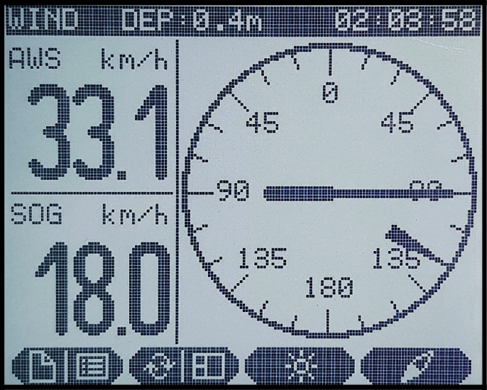
WIND page
The former vector AWA and vector TWA pages have been merged. For a better overview, the vectorial wind directions are on one page, the WIND page. The longer vector shows the Apparent Wind Angle. The actual wind is indicated by a smaller triangular arrow. This is the True Wind Angle. This way you know immediately what the wind is doing to your moving boat and where the wind is actually blowing from.
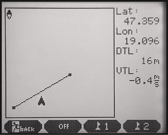
Layline menu
The Layline menu is designed to ensure that we start our boat in the most optimal place and time. In the wide start line of a race, we often have trouble deciding how far our boat is from the line. It is also difficult to judge whether we are moving towards the line at the optimum speed. To stop being an early starter, but also to stop missing the start, here's what we do: Go to the jury boat, press and hold the "buoy 1" button. Go to the jury buoy, press and hold "buoy 2". The instrument will display the distance to the line, their speed towards the line and the estimated time of arrival. If you have also started the start clock, the page will warn you with a "Warning" if you arrive before the start time.
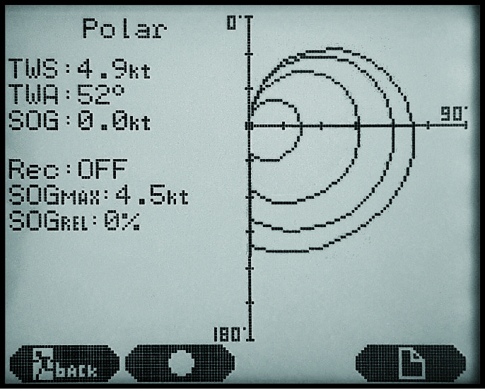
Polar diagram, polar data
A polar diagram describes the speed curve of a ship in different wind directions and at different wind speeds. The polar diagram of a sailing ship can be calculated on the drawing board, but it is slow and difficult to record it in real life. It is useful to know the polar curve because it allows us to decide whether our boat is performing at its maximum in a given race or whether we are slower than the theoretical maximum. With the latest software from Windwiser2 you are able to plot the polar curves with the help of the instrument. To do this you need to start a "record" and sail as much as possible. Meanwhile, the instrument collects the following information: wind direction (TWA) and the corresponding true wind speed (TWS), what was the maximum boat speed (SOG) reached by the boat. During your sailings, this data is displayed as a percentage. If the maximum is reached, the value will be 100%. If you are slower than this, the percentage is proportionally lower. The saved values can be transferred to the Windwiser Tools app and copied back. Caution! Using the engine during cruising will corrupt the polar data. In this case, the record must be stopped or not saved.
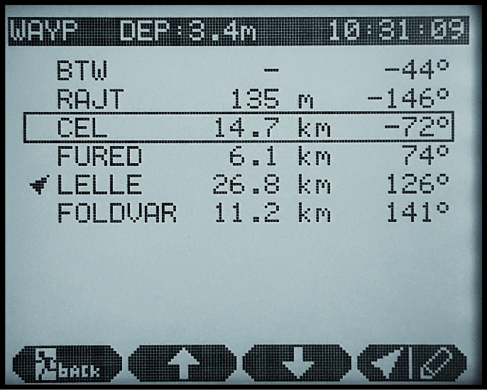
Waypoint menu
The "bearing" function has been added. In the 2019 version, you can now sail to predefined waypoints. In addition to Bearing (BTW), you can now specify 5 waypoints and two endpoints of the start line. The instrument displays the distance to the destination in km and the +/- deviation from course in degrees. On the main pages this data can be displayed numerically: BTW-Bearing To Waypoint, DTW-Distance To Waypoint, VTW-Velocity To Waypoint.
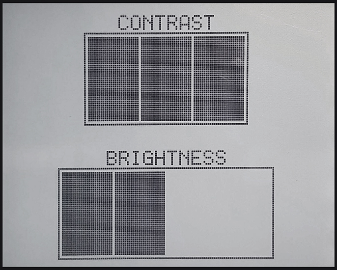
Contrast
LCD displays that are heated by sunlight. Due to their technology, they will darken as a result of the heat. To counteract this, you can adjust the brightness of the instrument as well as the contrast. Thus, the adjustment steps are as follows:
- 1 (low) contrast, without backlight
- Contrast 2 (medium), without backlight
- Contrast 3 (high), without backlight
- Contrast 4 (very high), without backlight
- Contrast 4 (very high) with 25% backlight
- Contrast 4 (very high) with 50% backlight
- Contrast 4 (very high) with 75% backlight
- Contrast 4 (very high) with 100% backlight
The contrast adjustment option is only available from the September 2018 purchase date, instruments purchased before this date do not have this feature.